Making location matter

Founded in 2006 and based in Athens and Patras, Geospatial Enabling Technologies works with public bodies and businesses in Greece and abroad. Our team specialises in managing and making use of spatial information, with deep experience in standards, software, open data and the natural environment.

General Commercial Registry (GEMI): 124537601000

  • Open knowledge
  • Reliability
  • Innovation
  • Teamwork
  • Continuous improvement
  • Quality

Our vision

To be recognised as the best geoinformatics provider in Greece, built on open standards, free software and open data, and making a real contribution to society and to the sharing of knowledge.

How we work

The principles behind every project, from the first study to long-term support.

Open standards

Solutions on OGC standards, in line with the directives and laws on managing information, such as INSPIRE and PSI.

The right software for each project

Free software is our first choice, and we deliver just as successfully with commercial platforms from Esri, Intergraph, Oracle and Microsoft.

Certified quality and security

ISO 9001 for quality management since 2010, and ISO 27001 for information security, the basis of our GDPR compliance.

Research and innovation

Research projects keep our solutions current. We are members of EARSC, si-Cluster, the Hellenic Association of Space Industry and the innovation clusters for IoT and for disaster resilience.

Social responsibility

We help public bodies make their data freely available, give students data and tools for their geoinformatics theses, and back initiatives such as the Copernicus Hackathon and AETHER, which monitors air pollution in Patras.

Twenty years on the map

  1. 01 / 21

    2006

    February 15, 2006

    Founding

    The company is founded and begins providing Geoinformatics solutions based mostly on Intergraph technology. It becomes the first company in Greece that develops solutions based on the Google Maps API.

  2. 02 / 21

    2007

    The First Projects

    We implement important projects, for Kathimerini in the private sector, and for the municipality of Athens in the public sector.

  3. 03 / 21

    2008

    INSPIRE Projects

    We successfully complete the first projects for the INSPIRE directive implementation in Greece, for the National Mapping Agency and the Ministry of Agriculture.

  4. 04 / 21

    2009

    Korinthos Project

    We complete the complex project for Fire Detection and Prevention for the Prefecture of Korinthos.

  5. 05 / 21

    2010

    Open Source

    A strategic partnership with Boundless is put in place. GET aggressively turns to providing geoinformatics solution development services based on mostly Open Source software.

  6. 06 / 21

    2011

    GETSDI Portal

    The first version of GETSDI Portal is made available through a GPLV3.

  7. 07 / 21

    2012

    RAE

    At the INSPIRE conference in Istanbul we present the Geoportal for the Regulatory Authority of Energy, which is based on our GETSDI Portal.

  8. 08 / 21

    2013

    SDI

    Our first SDI projects are implemented, to help local governments comply with the INSPIRE directive, and at the same time help reform their income policies.

  9. 09 / 21

    2014

    Expanding Abroad

    We win our first project abroad, in Ghana, Ecuador, and the United Kingdom, and we implement the first Open Data Portal in local government at the Municipality of Gortynia. We become ODI and OGC members.

  10. 10 / 21

    2015

    Share Capital Increase

    The Spatial Data Infrastructure for the municipality of Thessaloniki is completed successfully. The company’s capital is increased in resources and skills, and we are expanding in new areas of activity such as Business Intelligence and the Environment. We become an SI-Cluster member.

  11. 11 / 21

    2016

    Geodata

    Using our technology GETSDI Portal, the research project Aquanet is delivered. PublicaMundi project is successfully completed and the new website www.getodata.gov.gr goes live.

  12. 12 / 21

    2017

    July 5, 2017

    GET OPEN DATA

    Following the cooperation with SINERGISE, GET provides Sentinel Satellite Data as a Service and develops a variety of applications for sectors like the environment, agriculture and crisis management.

  13. 13 / 21

    2018

    Research projects

    The year was marked by the launch of 5 new research projects that will increase the Company’s know-how in new areas such as participatory planning, cultural heritage management, climate change impact monitoring and marine environment monitoring through modern observation tools of the land.

  14. 14 / 21

    2019

    Application for Urban Planning

    GET’s solution for the management of Urban Planning Information and the provision of web services to citizens and professionals is applied in many Municipalities of Greece: Municipality of Thessaloniki, Municipality of Heraklion, Municipality of Chania, Municipality of Maroussi, Municipality of Chalandri, Municipality of Keratsini, Municipality of Cholargou – Papagou , Municipality of Zitsa, Municipality of Agios Nikolaos, Municipality of Gortynia, Municipality of Corfu, Municipality of Agia Paraskevi etc.

  15. 15 / 21

    2020

    Projects for the Management of Cultural heritage

    Our involvement in cultural heritage management projects resonates and is applied to cultural projects in Greece and abroad. The solution is based on the results of the successful research project “Mouseion Topos” and offers new methodologies for digitizing and disseminating information about the building stock in areas of significant architectural beauty.

  16. 16 / 21

    2021

    GET Data Service for Digital Twins

    During 2021 we expanded our solutions through the creation of the new business unit “Data for Digital Twins”. Through it, we offer new 4D data collection services. The solution is based on the recording and utilization of data from UAVs as well as ground-based means of collection, based on moving panoramic cameras – scanners (Mobile Mapping).

  17. 17 / 21

    2022

    Flagship Projects for RAE

    Following the services, we have been providing to RAE continuously since 2007, in 2022 we developed the Electronic Registry Certifying Electricity Producers for the Regulatory Authority for Energy, which included complex identification procedures, interbank transactions and automated workflows regarding geospatial and non-geospatial data and elements.

  18. 18 / 21

    2023

    SDI & DIGITAL TWINS FOR THE MUNICIPALITY OF CHANIA

    Combining the Spatial Data Infrastructure with the Data for Digital Twins service, GET, with the Municipality of Chania as its client, expanded the SDI. to a new level of functionality that now allows the management of new types of data (three-dimensional point cloud) and their combined utilization along with panoramic images and other geospatial data, for full supervision, measurement extraction, digitization of geospatial features, creation of maps, etc. The project contributes to the creation of a modern Smart City Control Center and to the enhancement of business continuity of critical activities in the event of an incident, as by acquiring high-precision data, all that knowledge is created that can both prevent incidents and help in their quick recovery.

  19. 19 / 21

    2024

    AXIS 2 CONSTELLATION OF SATELLITES

    In collaboration with Open Cosmos, we will develop at least six applications that utilize satellite data from both Greek satellites and the entire Open Cosmos satellite swarm. These applications aim to address global challenges, such as forest monitoring and protection, and precision agriculture, as well as natural and climate risk assessment to support ESG actions of banking and insurance market, among others.

  20. 20 / 21

    2025

    Cloud Computing Service and Geospatial Information System for the Hellenic Space Center (HSC)

    Together with the company EoFARM, we delivered and placed into pilot operation the project of the Hellenic Space Center (https://hsc.gov.gr/), which concerns the creation of a “Cloud Computing Service and Geospatial Information System.” The purpose of this project is the development and operation of an Integrated Geospatial Information System (IGIS) that makes extensive use of cloud computing services for the storage, management, processing, and secure distribution to end users of high-resolution Earth observation satellite data from different satellite sensors, which are collected by the organization.

  21. 21 / 21

    2026

    Integration of EOFarm

    In 2026, a strategic agreement was reached for the integration of EOFarm. This move marks the creation of "New GET," a stronger business entity with an international orientation. The two companies join forces, significantly enhancing the scope, momentum, and strategic position of New GET as the premier Greek provider of reliable Geoinformatics solutions based on Free and Open Source Software for Geospatial (FOSS4G).


The people behind GET

Engineers, developers and scientists who love maps, data and open source. We’re always glad to meet people who do too.

  • Kyriaki Lainaki

    Accounting Administrative Assistant

    With extensive experience in supporting the Accounting and Procurement departments and a background in Business Administration studies, she is responsible for the smooth daily operation of the company GET.

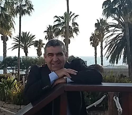
  • Gabriel Mavrellis

    CEO & Founder

    Thirty six years of experience in all processes of Geo-Informatics sector. He plans the strategy of the company and participates actively in its business development through new projects, markets, solutions, partnerships. He is Rural and Surveying Engineer with expertise in Business Administration. He dynamically supports the adoption of open standards, open source community actions and the idea of data and knowledge sharing.

  • Angelos Tzotsos

    Chief Geospatial Architect

    Angelos Tzotsos holds a Diploma in Rural and Surveying Engineering from NTUA and a PhD from NTUA specializing in Remote Sensing. It has been active for decades in the field of geoinformatics, with a strong scientific and technological footprint at national and international level.

    He is one of the most recognized personalities in the field of Free Software and Open Source Software for geospatial applications. He was President of the international organization Open Source Geospatial Foundation (OSGeo) and is a member of the Open Geospatial Consortium (OGC), actively contributing to the formation of international standards and good practices in geospatial technology.

    His research and scientific work focuses on Remote Sensing, Object-Oriented Image Analysis, Machine Learning and Artificial Intelligence, with applications in critical areas of public administration, environment and digital governance.

    He has served as a scientific and technical coordinator in projects of emblematic importance, such as the US National Open Data Catalog, the Greek Open Geospatial Data Catalog (geodata.gov.gr) as well as the Inspire National Portal at the Ministry of Environment and Energy. At the same time, he has supported as a technical advisor a number of public bodies, including the Municipality of Athens, the Ministry of Digital Governance and the Ministry of Environment and Energy.

    Utilizing exclusively free software, it also supports the digital transformation of local government by implementing important projects in Municipalities of the country, confirming its decisive role in connecting technological innovation with the real needs of society.

  • Maria Pahoula

    Chief Operating Officer (COO)

    With 20 years of experience in managing and implementing projects in Geoinformatics and Remote Sensing, and strong expertise in satellite Remote Sensing data, she is responsible for overseeing daily operations and executing the company’s strategy. At the same time, she actively contributes to the development of high-quality innovative solutions at GET, as well as to the management of projects and research programs. She holds a degree in Geology (NKUA) and an MSc in Geoinformatics (NTUA).

  • Panagiotis Symeonidis

    Chief Scientific Officer & Presales Manager

    He has significant expertise in environmental data management and in environmental (Geo)Informatics design and development, participating in projects concerning environmental data management, analysis and editing. He has Diploma in Physics, MSc in Environmental Physics and Ph.D in Environmental Database “Study in atmospheric pollution and its sources with the use of GIS”.

  • Andriana Aravani

    External Partner

    Accountant with 10 years of experience responsible for the daily operation of GET specialization in Accounting and Τax issues.She is a graduate of A.E.I. Piraeus TT in the Department of Accounting and Finance.

  • Simos Kamilieris

    External Partner

    He develops software and applications which cover technical requirements and needs of GET’s customers and partners, having technical expertise and education in Informatics and experience in Geo-Informatics. He is Informatics Graduate (Technological Institute of Lamia) with MSc in Computer Science (Hertfordshire University).

  • Achilleas Ntaralas

    Full Stack Developer

    Graduate of the Department of Computer Science and Engineering at the University of Thessaly. Specializing as a Full Stack Developer, he possesses a strong foundation in the entire software development lifecycle, from software design and architecture to backend and frontend implementation. Beyond web technologies, he has developed skills in Machine Learning and Neural Networks.

  • Thomas Papathymiopoulos

    Full Stack Developer

    Graduate of the Department of Informatics and Telecommunications at the University of Athens (NKUA), with professional experience in software development. He has worked on computer vision applications and currently works at GET as a software engineer.

  • Theodoros Gatsios

    GIS & Remote Sensing Engineer

    He holds an MSc in Geophysics (NKUA) and a BSc in Geology (University of Patras). He has a significant research experience in satellite remote sensing, particularly in Multi-Temporal SAR interferometry (MTInSAR).

  • Elpida Gkouvra

    GIS and Mobile Mapping Engineer

    She is a Rural, Surveying and Geoinformatics Engineer (NTUA), specializing in photogrammetry. Her diploma thesis involves the use of Deep Learning Models in Mobile Mapping applications, while she works as a GIS and Mobile Mapping Engineer in GET company.

  • Simos Taskaris

    GIS Developer / GIS Analyst

    He has important experience in Geographic Information Systems and he participated in desktop and web GIS applications development projects. He is graduate Regional and Urban Planning Engineer (University of Thessaly), MSc in Transport Systems (Aristotle University of Thessaloniki) and MSc in Informatics (Hellenic Open University).

  • Dimitris Dimitrelis

    GIS Engineer

    Graduate Forester – Environmentalist of the Department of Forestry and Natural Environment of the Aristotle University of Thessaloniki, with postgraduate degrees in Data Science and Machine Learning as well as in Environmental Design of Infrastructure Works from the Hellenic Open University.

    With five years of experience in geoinformatics and remote sensing applications as well in computer programming using the python language. In addition, he has experience in machine learning related to autonomous vehicle driving using computer vision algorithms.

  • Georgia Mavrokefalou

    GIS Engineer

    She is graduate of Geography Department of Harokopeion University with MSc in Applied Geography with direction in Geo-Informatics. She has a PhD from the Physics department of the Aristotle University of Thessaloniki in collaboration with the Environmental Radioactivity Laboratory of the Institute of Nuclear & Radiological Services & Technology, Energy & Safety of NCSR Democritos. Her research is entitled “Study on the relation of radioactive pollution and satellite observations of marine parameters and comparative analysis on a Geographic Information System”.

  • Katerina Bartsoka

    GIS Engineer

    She is a Surveying Engineer (NTUA) with MSc in “Environment and Development” at the same university. Has significant experience in Cadastral studies and Environmental Permissions for projects in the energy sector.

  • Lampros Syrakos

    GIS Engineer

    He is an Urban Planning Engineer (AUTH) with MSc in Geoinformatics (NTUA). He has professional experience in the processing, analysis and visualization of geospatial data, the management of spatial databases, and the development of web-mapping applications. He has participated in urban and spatial planning projects, and his research interests include spatial analysis, remote sensing and photogrammetry.

  • Efstathios Lymperis

    Software Engineer

    He graduated from the Geology department of Aristotle University of Thessaloniki, where he was involved with the application of modern computational methods in technical geology. Since then, he has been working as a geoinformatics engineer implementing spatial information tools and systems, as well as projects on spatial analysis and cartography.

  • Stavros - Periklis Lyras

    Technical Lead

    Brings extensive experience in the design and development of information systems, with expertise in database technologies (SQL & NoSQL) and modern programming languages. Has served as a Tech Lead, guiding development teams and contributing to the design of scalable architectures for complex software projects. Has delivered enterprise-grade applications, covering the full software development lifecycle — from requirements analysis to implementation and performance optimization.

    Holds a degree in Informatics and Telecommunications from the National and Kapodistrian University of Athens (NKUA). With over 14 years of professional experience, consistently contributes to the successful delivery of demanding technology projects.